
Finding People Along a Murrieta Street
A street search needs a fixed starting point. Use the complete number and street name, then treat the first result as a parcel clue rather than a resident conclusion. Riverside County’s online assessor tool can return a parcel by address, while the county’s public office can provide ownership information from the address or APN. Map My County then lets a researcher see the subject polygon and its neighbors. The recorder uses names, not a reliable address search, so the APN and legal description must bridge the two systems.
The useful address workflow is short, but each step answers a different question. Keep the source, date, and meaning of every result in your notes.
- Enter the street number and street name in Riverside Assessor Online Services. Record the APN, situs, subdivision clue, and any legal-description reference.
- Open the parcel in Map My County, confirm that the parcel layer is active, and click the polygons bordering the subject lot.
- Take the APN or address to an ACR office to identify the owner. The owner name is suppressed from the online assessor result.
- Search the recorder’s grantor-grantee index by the confirmed name, date range, and deed-related document type. Match the legal description on each hit.
- Use Murrieta permit activity, approved records, and any confirmed historical directory or census source to add time and household context.
The result is an address record trail, not a promise that every person at the property will appear.
Note: The APN is the bridge from a street address to a county owner search, but it never supplies an occupant list.
Murrieta Street Search Fields
Riverside Assessor Online Services accepts three useful routes: the first nine digits of an assessment number, a PIN, or a street address. For the APN route, omit the dash and final check digit. For an address route, enter the street number and street name. The result can display APN or PIN, situs address, assessed land and improvement values, total assessed value, tax-rate area, property characteristics, and legal-description or subdivision references allowed online.
The assessor search has a narrow purpose. It locates the parcel and supplies the identifier that the recorder, GIS viewer, permit reports, and tax material can share. It does not show the owner name on the web. The county’s property search instructions are the right reference for field formatting when an address has a unit, a new subdivision, or an uncertain street spelling.
| Field or control | Required route | Murrieta search note |
|---|---|---|
| APN / assessment number | Alternative to address | Use the first nine digits; leave off dash and check digit. |
| PIN | Alternative to APN | Use when the property-identification number is known. |
| Property address | Alternative to APN | Street number plus street name gives the best parcel match. |
| Search | Submit control | Returns matching parcel facts, not online ownership. |
The APN is the key that makes a Murrieta street directory search durable. Street labels can vary, but a parcel and its legal description can keep the chain aligned.
The county FAQ image explains the online ownership boundary in plain terms. Link to the Riverside ACR FAQ before relying on a web result as if it named the owner.
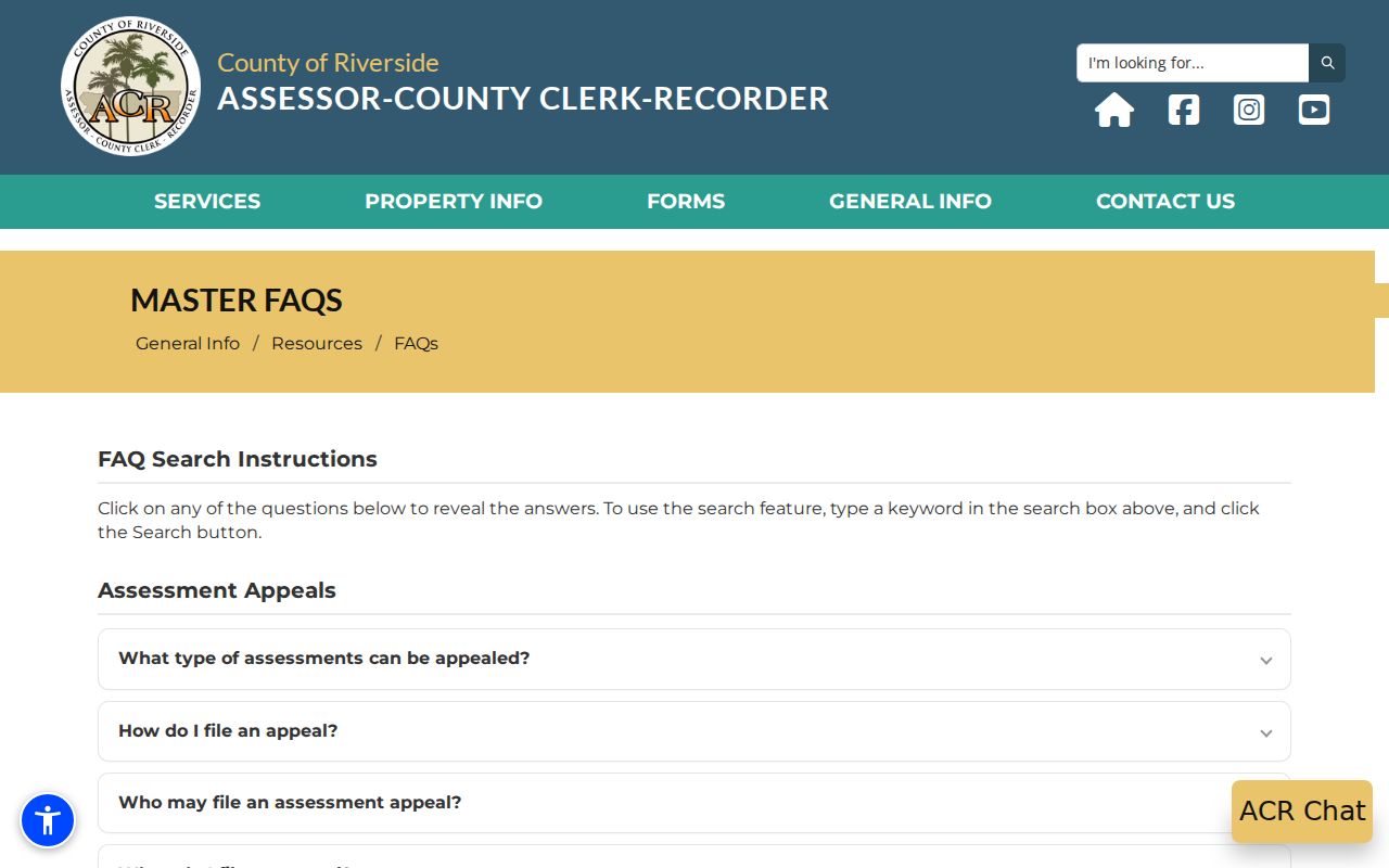
The missing name is intentional. Move to the counter with the APN or address, then return to the recorder index with the confirmed party.
Murrieta Resident Records Offline
Revenue and Taxation Code section 408 creates the practical split in the Murrieta street directory workflow. The public may inspect ownership at an assessor office, but the county online parcel search does not display owner identities. The nearest full ACR counter is at 41002 County Center Drive, Suite 230, Temecula, with weekday service from 8 a.m. to 4:30 p.m. The listed assessor telephone numbers are 800-746-1544 and 951-955-6200.
At the counter, distinguish the owner from the mailing recipient. The assessment roll can identify ownership as of January 1, while a recent transfer may appear first in the recorder’s documents. A tax mailing address is where the bill goes. It may differ from the physical situs, and neither fact establishes who is present day to day.
Once the office supplies the owner name, the ACR recorder name search can be narrowed with a recording date range, document types, and advanced operators. Preserve the exact name order and search variants because a misspelled or repeated surname can create a false branch.
Murrieta Street Blocks in GIS
Map My County is the best visual layer for moving from one parcel to the next. Search or zoom to the subject address, confirm that parcel boundaries and assessor identifiers are active, and use Identify on the subject polygon. Click each bordering polygon, record its APN, and pan along both sides of the block. The viewer can also expose addresses, district boundaries, aerial imagery, and measurement or identify tools. Check the active layer and date before treating a map label as current.
Murrieta’s own Maps and Zoning Information page adds city-limit, zoning, land-use, circulation, and development-activity context. A postal city label is not enough to determine incorporation. The city map helps separate a county parcel from a city record and explains why a street directory search can cross municipal and county custodians.
Keep the map result modest. GIS shows parcel geometry and public layers. It does not prove a household relationship, a current occupant, or a private association roster.
Note: A county parcel layer shows geometry and identifiers, not a private list of people nearby.
Murrieta Street Directory Record Sets
Several sources can be searched or organized by a Murrieta address, but their coverage and meaning differ. The table below is a street directory map: it tells which office owns the record, what a result can show, and where the next step belongs.
| Record set | Keeper | What it can show | Access |
|---|---|---|---|
| Assessment parcel | Riverside ACR Assessor | APN, situs, values, characteristics, legal clues; owner at office | Free address/APN search; counter inspection |
| GIS parcel map | Riverside County / Murrieta mapping | Lot shapes, adjacent parcels, addresses, districts, zoning layers | Free interactive viewers |
| Deeds and liens | Riverside ACR Recorder | Named parties, document type, recording date, title events | Free index; paid copies and certification |
| Permit activity | Murrieta Development Services | Address, APN, project, value, issue date, contractor | Monthly reports; detail by OnBase or request |
| Voter file | California SOS / Riverside Registrar | Registration information only for self-use or qualified purpose | Not a public street roster |
The APN ties the parcel to a permit and helps verify a deed. The street name helps humans browse the GIS layer. A qualified voter-file request has a different legal route. That is why a street directory must be read as a chain, not as a single list.
Note: The same address may lead to city, county, and state custodians with different release rules.
Murrieta Address Records and Permits
Monthly permit activity is one of Murrieta’s most useful address-keyed sources. A typical 2026 row exposes permit number and type, full site address and ZIP, category, stated valuation, square footage, issue date, nine-digit APN, and contractor. The row can date a physical change or identify a business connected to a project. It cannot show who lived at the site during construction.
Search the city’s Citizen Self Service permit environment for the public route, then use the OnBase Public Access Viewer for records already published. The Tyler environment launched March 1, 2023 and supports 24-hour submittal for many project types, but anonymous search fields and pre-2023 coverage were not verified. For older or missing records, give the City Clerk the address, APN, project number, date range, and desired record type.
The monthly index image is valuable because it keeps the street address beside the APN and project date. Use the Murrieta permit activity reports as a dated clue, then request the underlying plans or inspection material when the public row is not enough.
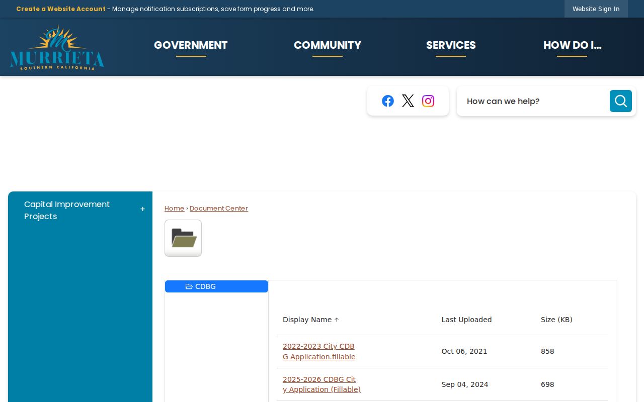
A permit belongs in the address history beside a deed, not in place of one.
The OnBase route supports full-text and keyword searches, mm/dd/yyyy date ranges, wildcards, exact phrases, Boolean operators, Soundex, fuzzy search, and proximity syntax. The city’s IB-119 records guide directs requesters to search OnBase first and then describe the missing address record to the City Clerk. An image icon opens a hit; files above 20 MB prompt a download. Use those controls for a precise record request rather than guessing at a department.
When a permit or plan includes a sealed architect or engineer drawing, the city may require authorization before duplication. The public report and a released plan are different access products.
The Murrieta Citizen Self Service permit portal shows the public permit route and its account areas for addresses, saved work, invoices, businesses, and contact management.
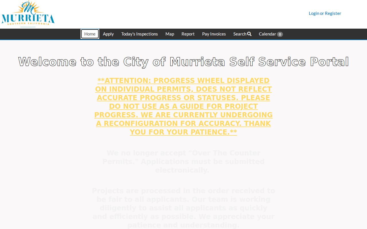
Use the portal for a record already available and the City Clerk when the index does not answer the address question.
Murrieta Deeds Along a Street
The Riverside recorder index is not a reliable street-address search. It is built around grantor and grantee names, where a grantor transfers an interest and a grantee receives it. Begin with the owner name from the assessor office, search the recording date range, select deed or lien-related types, and compare the APN or legal description on the hit. The document number, book or page reference, and recording date help identify the correct branch.
Advanced name controls can help with variant surnames. The portal supports exact and wildcard behavior plus operators such as plus to require a term, minus to exclude one, dollar sign for sounds-like matching, question mark for an uncertain letter, and asterisk for character completion. Search a compound surname and a spaced version where the portal rules allow it.
The Riverside recorder name-search capture shows the date, document-type, and advanced-search controls. It is the right shape of search for a street directory deed trail because it begins with a known party.
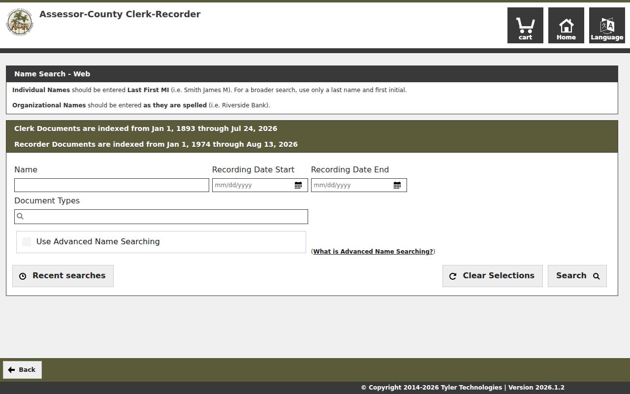
A name hit establishes an indexed recording. Read the document or order the copy before treating its legal description as proof of the current parcel.
Note: A recorder hit proves a recorded document, not that its named party still holds the parcel.
Murrieta Records Before 1974
Riverside recorder documents are indexed online from January 1, 1974, while county clerk documents begin in 1893. The office-computer wording reaches 1975, so a search note should report the difference rather than smoothing it into one date. For 1974 and earlier recorder research, Riverside ACR directs researchers to Gateway Riverside at 2724 Gateway Drive, Riverside, with weekday service from 8 a.m. to 5 p.m.
Current copies can be ordered online, at a counter, or by mail. A regular copy is $8 for the first page and $1 for each additional page; certification adds $2 per document. Online card processing adds 2.15 percent, with typical processing around 48 hours and mail delivery. Counter work may be same day unless older research is extensive. Mail requests use form ACR515 and the certified section address listed by the county.
The recorded-document copy instructions explain the channels and the pre-1974 fallback. When the document number is unknown, include the title or type, complete party names, estimated recording date, and APN if available.
For pre-1976 requests with an estimated year, staff searches only two years after that year. A narrow date range and the legal description save time.
Murrieta Street Address Labels
A street directory can blur three addresses unless each is labeled. Situs is the physical location of the parcel. Mailing address is where an owner’s tax notice goes. Legal description identifies the lot, block, subdivision, or metes-and-bounds boundary in the recorded instrument. The APN is a tax identifier. A ZIP code is a postal routing label. They can point to the same place while serving different systems.
Use the legal description to test a deed chain when a street label changes, a subdivision expands, or a postal city differs from the city line. Murrieta’s 1884 townsite had an oblique grid with Kalmia, Juniper, and Ivy running northeast to southwest and Washington, Clay, and Hayes running northwest to southeast. Old maps, subdivision plans, GLO plats, and USGS sheets are stronger bridges than an assumed street-renumbering story.
- Parcel
- A taxable piece of land tracked by an APN.
- Situs address
- The physical property location, not necessarily the tax-mailing destination.
- Plat
- A recorded map that lays out lots, blocks, streets, or easements.
- Criss-cross directory
- A reverse directory organized by street and number rather than only by personal name.
These definitions keep a Murrieta street directory result from overstating what the source proves.
Murrieta Street Reverse Sources
A reverse or criss-cross directory could be the most direct historical street tool because it starts with a number and street heading. Murrieta’s Heritage Room and Riverside Public Library Local History are the places to ask whether a local run exists, which years it covers, and whether it lists subscribers, owners, or occupants. The research sweep did not verify a continuous Murrieta-specific Polk or criss-cross series, so no year run or publisher should be assumed.
If a volume is found, inspect the street section, house-number order, cross streets, vacant lots, rear units, abbreviation key, and the difference between a telephone subscriber and a resident. Pair the listing with a deed, permit, obituary, yearbook, or census schedule. The historical shelf and its verified collections belong on the Murrieta city directory collections page, not in a guessed street list.
That honest gap is useful. It directs a researcher toward a reproducible archive question instead of a fabricated directory year.
Murrieta Street Directory Limits
No public street directory identifies every person present at a parcel. A deed identifies title parties. A permit identifies a project. A voter file is purpose-restricted. The assessor mailing address is a tax destination. Utility customers, delivery records, DMV addresses, protected Safe at Home participants, and unlisted household members are not open street fields.
Even a strong address match needs restraint. A non-owner occupant may never appear in the assessment roll, and a recorded owner may live elsewhere. A familiar name in a court or business record is not identification without a second anchor such as the APN, legal description, middle name, date range, or family relationship documented by an appropriate source.
Lawful use. Murrieta address and parcel records support personal, lawful research. Do not use a street directory trail to stalk, harass, intimidate, or harm another person; California Penal Code sections 646.9 and 653.2 address serious forms of that conduct.
When the goal shifts from a whole street to one person, use the resident-search workflow and verify the record with its custodian rather than widening the search indiscriminately.